Convenience Stores

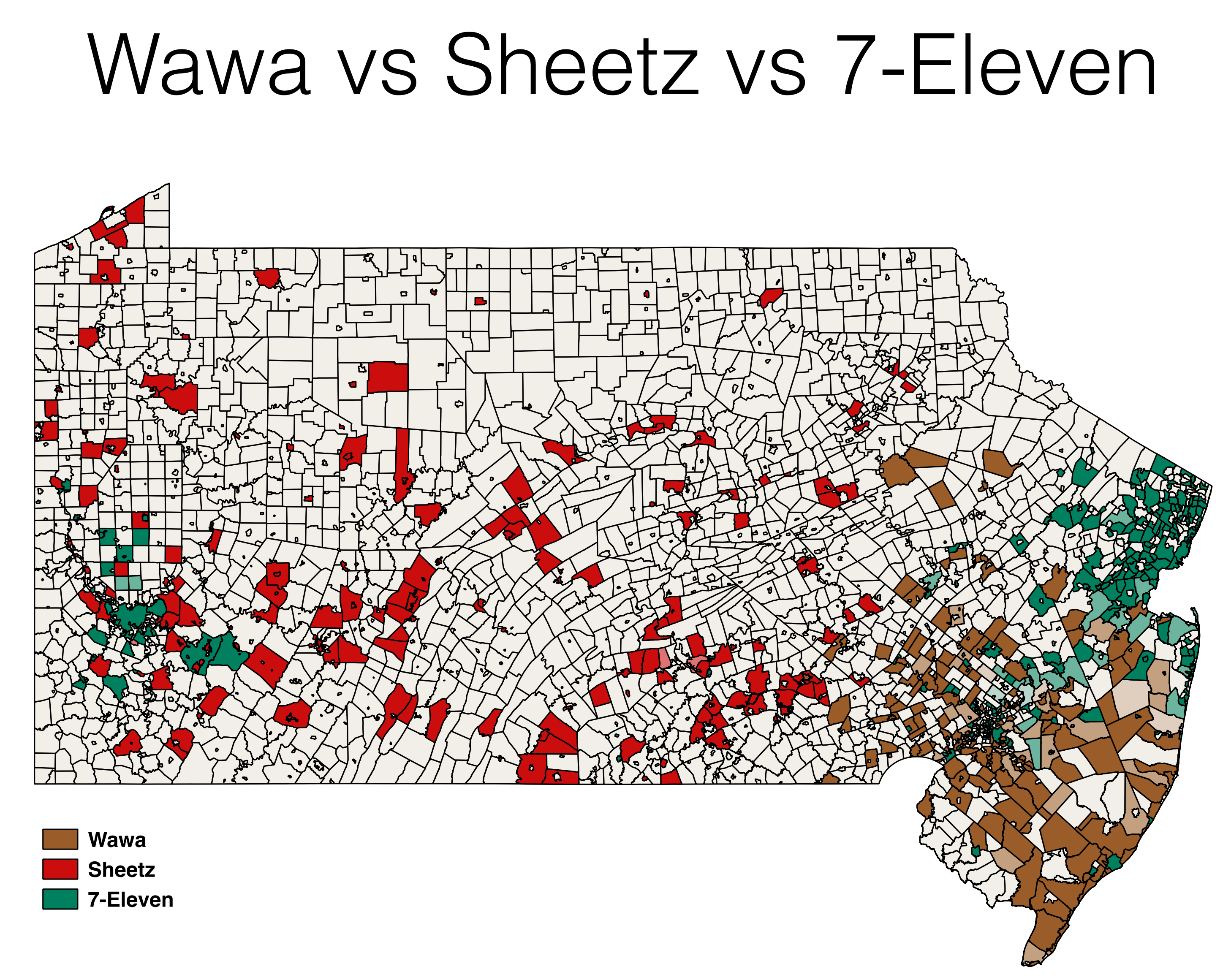
This map shows the distribution of Wawa, Sheetz and 7-Eleven locations in Pennsylvania and New Jersey. The darker the color the higher percentage of that store brand of all stores in that municipality. You can make out the north vs south divide in New Jersey. Sheetz clearly goes for rural Pennsylvania over urban which is dominated by 7-Eleven.
This was my first try at making a map in QGIS. It wasn’t easy but it eventually worked (until it crashed and lost my project 😩).
There’s a script to do the fetching if you want to mess with the data. But if your interested in a much more far reaching project to collect all the things check out Ian Dees’ effort. I’m excited to see what can be scraped out there.